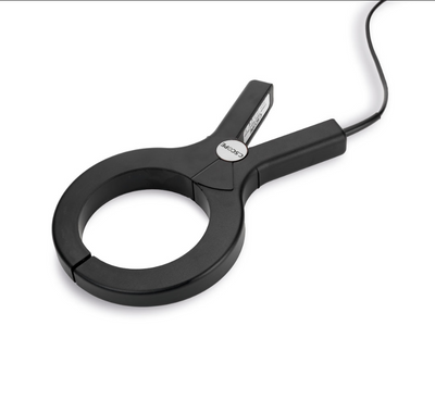
i85 w/ HCE600 Rover Kit - COMPACT AND EFFICIENT LASER IMU RTK GNSS
CHCNAV HCE600
Rugged Field Controller for Surveying and Mapping

Highlights
The HCE600 is a lightweight, professional Android data collector designed for field surveying and mapping. With a 5.5-inch DragonTrail™ display, it offers exceptional durability and clear visibility in sunlight. Packed with Bluetooth 5.0, dual-band Wi-Fi, and a 4G modem, it ensures seamless connectivity with GNSS receivers and RTK networks. Certified to IP68 and MIL-STD-810H standards, the HCE600 is built to withstand harsh environments, making it the ideal handheld controller for reliable data collection in any conditions.
Main Features
DragonTrail™ Glass
5.5-inch HD+ screen with 500 nits brightness.
Rugged
IP68 and MIL-STD-810H for dust, water and shock resistance.
Long Battery Life
6240 mAh battery for up to 14 hours of continuous operation.
High Connectivity
Bluetooth 5.0, dual-band Wi-Fi, 4G modem.
Benefits and Performances
Powerful Performance
Achieve high performance with the Helio MTK 6762 octa-core processor running at up to 2 GHz. Android OS coupled with 3GB of SDRAM and 32GB of flash memory ensure smooth operation and efficient data processing.
High-Visibility Display
Work efficiently in any lighting condition with the 5.5-inch, 500 nits HD+ display. The screen provides clear, legible data even in direct sunlight, enabling uninterrupted fieldwork.
Comprehensive Connectivity
Enjoy seamless connectivity to GNSS receivers and RTK networks with Bluetooth 5.0, dual-band Wi-Fi (2.4G/5G) and a built-in 4G modem. The HCE600 ensures reliable communication and data transfer in the field.
Rugged and Durable Design
The HCE600's IP68 and MIL-STD-810H-rated housing can withstand harsh field conditions. The DragonTrail™ glass display offers scratch resistance and durability for long-term performance.
Lightweight and Ergonomic
Work in comfort with the HCE600's lightweight (345g) and ergonomic form factor. The one-handed grip and customizable shortcut keys enhance the user experience and make it easier to collect data.
Extended Battery Life
The HCE600 lithium-ion battery provides up to 14 hours of continuous use without frequent recharging, allowing you to work all day in the field.
Specification
Display
Screen size : 5.5" touchscreen
Screen resolution : 1440 x 720
Positioning
GNSS : GPS, GLONASS, Galileo, BeiDou
System
Operating System : Android
Processor : Octa-core 2.0 GHz
Memory : 3 GB SDRAM - 32 GB ROM
Connectivity
Wireless : Bluetooth, Wi-Fi, NFC
Cellular : 4G LTE, GSM, WCDMA
HIGH-PERFORMANCE GNSS ON TOP LASER
The i85 Laser IMU GNSS is a compact, 800 g receiver designed for demanding fieldwork. Equipped with a 1408-channel GNSS chip and CHCNAV’s iStar2.0 engine, it delivers consistent RTK performance, even in challenging conditions. Advanced ionospheric modeling maintains fix reliability during periods of increased solar activity.
The built-in laser module enables fast, accurate 3D point capture in obstructed or hard-to-reach areas. AUTO-IMU eliminates manual centering, allowing immediate measurements with tilt compensation. Combined with a high-speed SoC processor and next-generation IMU,the i85 enhances laser-based surveys.
With up to 20 hours of battery life and features such as AR navigation and visual stakeout, the i85 is built for efficiency across all experience levels.

WORLD LEADER IN GNSS
Equipped with CHCNAV’s multi-constellation, multi-frequency GNSS chip and proprietary iStar2.0 technology, the i85 delivers consistent, ultra-accurate positioning even in complex environments. It features an enhanced IMU that optimizes heading accuracy, enabling laser measurements accurate to 2 cm at 5 m and 3 cm at 10 m*. Its reinforced metal chassis and integrated all-in-one design ensure stable laser sensor alignment. Multi-sensor synchronization reduces latency and enhances calculation accuracy. An integrated temperature sensor adjusts measurement algorithms in response to environmental changes, while intelligent gain control adapts to lighting and signal conditions to ensure consistent laser measurement performance.
*Performance figures based on CHCNAV Lab testing. Actual results may vary.
BRIGHT GREEN LASER
The i85 is equipped with an industrial-grade green laser that maintains high visibility across a wide range of surfaces. Resistant to ambient light levels up to 50,000 lux, comparable to direct midday sunlight, the laser remains clearly visible, allowing accurate targeting even under bright outdoor conditions.
Optimal visibility on all surfaces
CLEAR LONG-RANGE SHOTS
With the industry’s first true 8MP high-definition camera, the i85 offers precise visual targeting over long distances. The integrated camera functions like a high-definition telescope, keeping distant targets crisp and clearly defined even when zoomed in. Users can confidently aim and capture targeted points without interference from visual distortion or blurry images.
LASER MEASUREMENT WITH EXTENDED RANGE
The i85 overcomes GNSS signal limitations in obstructed environments such as under dense foliage or near tall structures through a hybrid GNSS and laser ranging solution. Its integrated high-precision laser enables accurate data collection in areas that are physically difficult or unsafe to access. Data acquisition efficiency improves by more than 50%, reducing collection time from minutes to seconds. Whether surveying across rivers, behind barriers, or near hazardous zones, surveyors can collect data remotely without direct exposure to risk. The i85 enables safe, efficient, and accurate measurement even under the most challenging field conditions.
SMART AUTO-FOCUS
The i85’s high-performance embedded processor powers real-time image processing, ensuring clear views with ultra-low latency. It automatically adjusts focus and zoom based on user behavior, and after a brief aiming period, the device assists in capturing point data without requiring manual input. The intelligent autofocus feature streamlines operation and minimizes handling, enabling greater productivity.

| Shipping | This Item Ships from Fremantle, Perth, Western Australia |
Please allow 2 - 10 days for your order to arrive.
Although Most Stocked Products will generally Ship Overnight. We source products from all over the world to bring you epic offers and the lowest prices. This means sometimes you have to wait a little longer to get your order but it's always worth it!
Returns are easy.
simply contact us for a returns number and send your item to our returns centre for fast processing. We'll get you a replacement or refund in a snap!
Description
i85 w/ HCE600 Rover Kit - COMPACT AND EFFICIENT LASER IMU RTK GNSS
CHCNAV HCE600
Rugged Field Controller for Surveying and Mapping

Highlights
The HCE600 is a lightweight, professional Android data collector designed for field surveying and mapping. With a 5.5-inch DragonTrail™ display, it offers exceptional durability and clear visibility in sunlight. Packed with Bluetooth 5.0, dual-band Wi-Fi, and a 4G modem, it ensures seamless connectivity with GNSS receivers and RTK networks. Certified to IP68 and MIL-STD-810H standards, the HCE600 is built to withstand harsh environments, making it the ideal handheld controller for reliable data collection in any conditions.
Main Features
DragonTrail™ Glass
5.5-inch HD+ screen with 500 nits brightness.
Rugged
IP68 and MIL-STD-810H for dust, water and shock resistance.
Long Battery Life
6240 mAh battery for up to 14 hours of continuous operation.
High Connectivity
Bluetooth 5.0, dual-band Wi-Fi, 4G modem.
Benefits and Performances
Powerful Performance
Achieve high performance with the Helio MTK 6762 octa-core processor running at up to 2 GHz. Android OS coupled with 3GB of SDRAM and 32GB of flash memory ensure smooth operation and efficient data processing.
High-Visibility Display
Work efficiently in any lighting condition with the 5.5-inch, 500 nits HD+ display. The screen provides clear, legible data even in direct sunlight, enabling uninterrupted fieldwork.
Comprehensive Connectivity
Enjoy seamless connectivity to GNSS receivers and RTK networks with Bluetooth 5.0, dual-band Wi-Fi (2.4G/5G) and a built-in 4G modem. The HCE600 ensures reliable communication and data transfer in the field.
Rugged and Durable Design
The HCE600's IP68 and MIL-STD-810H-rated housing can withstand harsh field conditions. The DragonTrail™ glass display offers scratch resistance and durability for long-term performance.
Lightweight and Ergonomic
Work in comfort with the HCE600's lightweight (345g) and ergonomic form factor. The one-handed grip and customizable shortcut keys enhance the user experience and make it easier to collect data.
Extended Battery Life
The HCE600 lithium-ion battery provides up to 14 hours of continuous use without frequent recharging, allowing you to work all day in the field.
Specification
Display
Screen size : 5.5" touchscreen
Screen resolution : 1440 x 720
Positioning
GNSS : GPS, GLONASS, Galileo, BeiDou
System
Operating System : Android
Processor : Octa-core 2.0 GHz
Memory : 3 GB SDRAM - 32 GB ROM
Connectivity
Wireless : Bluetooth, Wi-Fi, NFC
Cellular : 4G LTE, GSM, WCDMA
HIGH-PERFORMANCE GNSS ON TOP LASER
The i85 Laser IMU GNSS is a compact, 800 g receiver designed for demanding fieldwork. Equipped with a 1408-channel GNSS chip and CHCNAV’s iStar2.0 engine, it delivers consistent RTK performance, even in challenging conditions. Advanced ionospheric modeling maintains fix reliability during periods of increased solar activity.
The built-in laser module enables fast, accurate 3D point capture in obstructed or hard-to-reach areas. AUTO-IMU eliminates manual centering, allowing immediate measurements with tilt compensation. Combined with a high-speed SoC processor and next-generation IMU,the i85 enhances laser-based surveys.
With up to 20 hours of battery life and features such as AR navigation and visual stakeout, the i85 is built for efficiency across all experience levels.

WORLD LEADER IN GNSS
Equipped with CHCNAV’s multi-constellation, multi-frequency GNSS chip and proprietary iStar2.0 technology, the i85 delivers consistent, ultra-accurate positioning even in complex environments. It features an enhanced IMU that optimizes heading accuracy, enabling laser measurements accurate to 2 cm at 5 m and 3 cm at 10 m*. Its reinforced metal chassis and integrated all-in-one design ensure stable laser sensor alignment. Multi-sensor synchronization reduces latency and enhances calculation accuracy. An integrated temperature sensor adjusts measurement algorithms in response to environmental changes, while intelligent gain control adapts to lighting and signal conditions to ensure consistent laser measurement performance.
*Performance figures based on CHCNAV Lab testing. Actual results may vary.
BRIGHT GREEN LASER
The i85 is equipped with an industrial-grade green laser that maintains high visibility across a wide range of surfaces. Resistant to ambient light levels up to 50,000 lux, comparable to direct midday sunlight, the laser remains clearly visible, allowing accurate targeting even under bright outdoor conditions.
Optimal visibility on all surfaces
CLEAR LONG-RANGE SHOTS
With the industry’s first true 8MP high-definition camera, the i85 offers precise visual targeting over long distances. The integrated camera functions like a high-definition telescope, keeping distant targets crisp and clearly defined even when zoomed in. Users can confidently aim and capture targeted points without interference from visual distortion or blurry images.
LASER MEASUREMENT WITH EXTENDED RANGE
The i85 overcomes GNSS signal limitations in obstructed environments such as under dense foliage or near tall structures through a hybrid GNSS and laser ranging solution. Its integrated high-precision laser enables accurate data collection in areas that are physically difficult or unsafe to access. Data acquisition efficiency improves by more than 50%, reducing collection time from minutes to seconds. Whether surveying across rivers, behind barriers, or near hazardous zones, surveyors can collect data remotely without direct exposure to risk. The i85 enables safe, efficient, and accurate measurement even under the most challenging field conditions.
SMART AUTO-FOCUS
The i85’s high-performance embedded processor powers real-time image processing, ensuring clear views with ultra-low latency. It automatically adjusts focus and zoom based on user behavior, and after a brief aiming period, the device assists in capturing point data without requiring manual input. The intelligent autofocus feature streamlines operation and minimizes handling, enabling greater productivity.

Shipping
| Shipping | This item ships to |
Delivery & Returns
Please allow 2 - 10 days for your order to arrive.
Although Most Stocked Products will generally Ship Overnight. We source products from all over the world to bring you epic offers and the lowest prices. This means sometimes you have to wait a little longer to get your order but it's always worth it!
Returns are easy.
simply contact us for a returns number and send your item to our returns centre for fast processing. We'll get you a replacement or refund in a snap!
6 Great reasons to buy from us:
-

30 Days Return
If your product is faulty or damaged under manufacture warranty, simply send it back to us and we'll cheerfully replace it or fix the problem for you. -

Returns are Easy
Simply contact us for a returns number and send your item to our returns centre for fast processing. We'll get you a replacement or refund in a snap! -

Best Price Guarantee
In the unlikely event that you find your item cheaper at another online store, just let us know and we'll beat the competitor's pricing hands-down. -

We guarantee your satisfaction
We insist that you love everything you buy from us. If you're unhappy for any reason whatsoever, just let us know and we'll bend over backwards to make things right again. -

100% Safe & Secure
Ordering from Laserman Technologies is 100% safe and secure so you can rest easy. Your personal details are never shared, sold or rented to anyone either. -

Best Laser Warranties in the Business
Laserman the Best Laser Level, Pipe Laser and Laser Measuring Warranties in the Business - Now thats unbeatable value !!.


